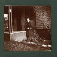
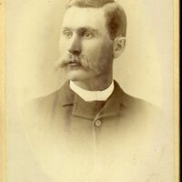
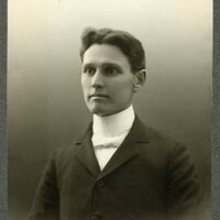
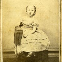
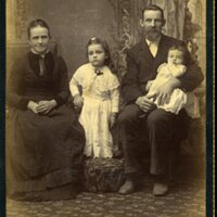
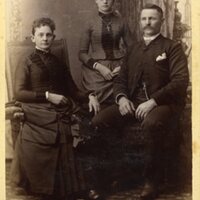
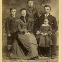
Browse Items (4827 total)
- Tags: Decatur IL
Illinois Central Railroad Tracks - North from Routes 48 & 121 (6/30/1958)
Illinois Central Railroad Station Plat - J.L. Simmons Company & The Checkerboard Soybean Co. (original 4/18/1950, last revised 1/23/1959)
Tags: #8.003, 1/23/1959, 1950, 1959, 4/18/1950, collection, Decatur IL, ICRR, Illinois Central Railroad, Illinois Terminal Railroad, ISHRAB, ISHRAB-2017-25-41, ITS, J.L. Simmons Co., map, Maps, property of Arnold H. Heinkel and Wf, property of Herbert R. Heinkel and Wf, Railroad Map Collection, Shellabarger property line, The Checkerboard Soybean Co., Tracks
Illinois Central Railroad Track Map - Green St (27th St.) to Brush College Rd. (10/26/1953)
Illinois Central Railroad Company Station Plat - Wilbur St. to N. Clinton St. (1/14/1911)
Tags: #8.003, 1/14/1911, 1911, Alexander Lumber Company, Beiman Heights Addition, C.C. Morrison Addition, C.W. Handy Addition, Church Hill Addition, collection, Decatur IL, E. Center St., E. Division St., F.M. Gaddis Addition, Francis St., Garfield Ave., Graceland Ave., Grand Ave., Harrison Ave., Hunter Bros. Addition, I.A. William's Resurvey, ICRR, Illinois Central Railroad, Illinois Central Railroad Company, Illinois Traction System, ISHRAB, ISHRAB-2017-25-85, ITS, Johnson Ave., M. Johnson subdivision, map, Maple St., Maps, N. Broadway St., N. Church St., N. Clinton St., N. College St., N. Edward St., N. Main St., N. Monroe St., N. Morgan St., N. Union St., N. Warren St., N. Water St., Olive St., Property of W.G. Traver Co., Railroad Map Collection, Richview, Roadmaster's Office, station plat map, W. Johnson St., Whitchell Addition, Whitchell Ave., Wilbur St., William's Subdivision
Wabash Railway Station Map: Lands, Tracks, and Structures - Fairview Ave. to College St. (6/30/1938)
Tags: 1938, 6/30/1938, A.Wait's et all A&P Addition, Adamson & Prather's Addition, additions, Anna B. Millikin Home, Avenue Park Addition, Bright St., businesses, Caldwell's Resurvey, Cerro Gordo St., collection, College St., Cottage Hill St., Decatur IL, Dunham's Addition, E.B. Durfee's 1st Addition, E.B. Durfee's 2nd Addition, E.B. Durfee's 3rd Addition, F.E. Kinney's Addition, Fairview Ave., George A. Wessel's Addition, H.A. Wood's Addition of Outlots, H.H. Brown's 2nd Subdivision, H.H. Brown's Subdivision, H.S. Evan's 2nd Subdivision, H.S. Evan's Subdivision, Haworth Ave., Hiram Johnson's Subidivision, Home Ave., ISHRAB, ISHRAB-2017-25-107, John Allen resurvey, lands, Locus Addition, map, Maps, Marilla Dunham Place, McCaskill's 2nd Addition, McCaskill's 3rd Addition, Millikin Place., Millikin's 2nd Addition, Millikin's Addition, N. Mercer St., N. Monroe St., N. Oakland Ave., N. Pine St., Oakland Place, Oaklawn, Office of Chief Engineer, Peter H. Brueck's 2nd Addition, Peter H. Brueck's Addition, Polar Ice Co., Prairie Ave., Railroad Map Collection #8.003, S. Oakland Ave., S.K. Thompson's 2nd Addition, S.K. Thompson's Addition, Simpson's 2nd Addition, Simpson's Addition, station map, Streets, structures, Tracks, University Place, Van Dyke St., W. Decatur St., W. Eldorado St., W. Forest Ave., W. Green St., W. Macon St., W. Main St., W. North St., W. Williams St., W. Wood St., Wabash, Wabash Railroad, Wabash Railway, Wabash RR, Western Addition, Woodland Addition, Yates & King's Addition
Cincinnati, Indianapolis, & Western RR Right of Way and Track Map - Taylorville Rd to Sangamon River (original 6/30/1918, revised 1/7/1955)
Tags: #8.003, 1/7/1955, 1918, 1955, 6/30/1918, B&O, Baltimore & Ohio Railroad Company, Cincinnati Indianapolis & Western RR, collection, Decatur IL, ISHRAB, ISHRAB-2017-25-10, ISHRAB-2017-25-4, Knights ILLS, map, Maps, Office of Valuation Engineer, public road, Railroad Map Collection, revised, right of way, right of way and track map, Sangamon River, Taylorville Road, Track
Profile of the Illinois Traction Inc. Decatur Belt Line (6/17/1925)
Tags: #8.003, 1925, 6/17/1925, belt line, Center St., Church St., Cushing St., Decatur IL, Dunham St., Elevation, Fairview Ave., Grand Ave., Green St., Harrison St., ICRR, Illinois Central Railroad, Illinois Traction Inc., ISHRAB, ISHRAB-2017-25-26, ITS, King St., Leafland Ave., McKinley Ave., N. Main St., N. Water St., Office of Engineer, profile, profile of Decatur belt line, Railroad Map Collection, Sawyer St., Streets, Union Blvd., Van Dyke St., Wabash, Wabash Railroad, Wabash Railway, Wabash RR, Wagner St.
Map of the Illinois Central Railroad Tracks Near Borg Warner on U.S. Hwy 51 (5/13/192?)
Partial Map of the Baltimore & Ohio Railroad Tracks over the Sangamon River at the Staley Bridge
Cincinnati, Indianapolis & Western RR Station Map: Lands, Tracks, and Structures - 6th St to 11th St. (6/30/1918) (Partial Map)
Tags: #8.003, 1918, 6/30/1918, additions, B&O, Baltimore & Ohio Railroad Company, Cincinnati Indianapolis & Western RR, collection, Decatur IL, E. Eldorado St., E. Main St., E. North St., E. Prairie St., E. William St., E. Wood St., East View, Elm Ridge, Elson Heights, ISHRAB, ISHRAB-2017-25-142, lands, map, Maps, N. 10th St., N. 11th St., N. 6th St., N. 7th St., N. 8th St., N. 9th St., Nelson Park Rd., Office of Valuation Engineer, Railroad Map Collection, station map, Streets, structures, Tracks, Urban Place