Browse Items (2 total)
- Tags: station maps
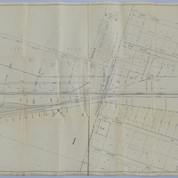
Wabash Railway Station Map: Lands, Tracks, and Structures - Thomas St. to James St. (6/30/1950?)
Tags: #8.003, 1950, 6/30/1950, additions, C.Y. Miller's 1st Addition, Camp & Emrich's 2nd Addition, Camp & Emrich's Addition, collection, Decatur IL, E. Division St., E. Grand Ave., E. Hickory St., E. Locust St., E. Logan St., E. Olive St., Fern Ct., ISHRAB-2017-25-94, ISHRAB-2017-25-95, James St., lands, map, Maps, Raceland Plat "C" in "Plat "C", Railroad Map Collection, Samuels St., station maps, Streets, structures, Thomas St., Tracks, Wabash, Wabash Railroad, Wabash Railway, Wabash RR, West Lake 2nd Addition of Out Lots, Westlake Additions of Outlots
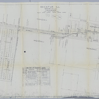
Station Maps of the Illinois Traction Inc., Operated by Illinois Terminal Company (12-31-1928)
Tags: #8.003, 12/31/1928, 1928, Butler Heights, Church St., collection, Decatur IL, Graceland Ave., Illinois Terminal Company, Illinois Traction Inc., ISHRAB-2017-25-42, ISHRAB-2017-25-43, ITS, Kenwood Ave., Maps, Maywood Court, McKinley Ave., Melrose Court, N. Main St., N. Water St., Office of Chief Engineer, Pythian Ave., Pythian Home, Pythian Home Addition, Railroad Map Collection, records of changes made, Resers Addition, Rosedale Addition, Rosedale Ave., station map, station maps, Tangney Addition, Union Blvd., Valuation Division


