Browse Items (6 total)
- Tags: public road
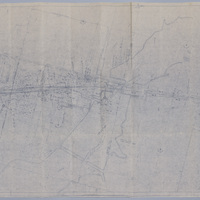
Cincinnati, Indianapolis, & Western RR Right of Way and Track Map - Taylorville Rd to Sangamon River (original 6/30/1918, revised 1/7/1955)
Tags: #8.003, 1/7/1955, 1918, 1955, 6/30/1918, B&O, Baltimore & Ohio Railroad Company, Cincinnati Indianapolis & Western RR, collection, Decatur IL, ISHRAB, ISHRAB-2017-25-10, ISHRAB-2017-25-4, Knights ILLS, map, Maps, Office of Valuation Engineer, public road, Railroad Map Collection, revised, right of way, right of way and track map, Sangamon River, Taylorville Road, Track
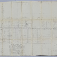
Illinois Central Railroad Tracks - Along State Route 48 (3/11/1953, revised 6/1/1964)
Tags: #8.003, 1953, 1964, 3/11/1953, 6/1/1964, American Oil Co., Cities Service Oil Co., Decatur IL, Green's Switch, Humble Oil Co., ICRR, Illinois Central Railroad, ISHRAB, ISHRAB-2017-25-34, Macon County Service Co., Morgan Sash and Door Co., Office of Assistant to Division Engineer, public road, Railroad Map Collection, revised, Simpson Building and Supply Co., State Route 121, State Route 48, Tracks
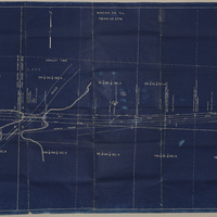
Wabash Railroad Right of Way and Track Map - 27th St. Through Lake Decatur (7/1/1953)
Tags: #8.003, 1953, 24th St., 25th St., 26th St., 27th St., 29th St., 31st St., 32nd St., 33rd St., 34th St., 35th St., 7/1/1953, A.E. Staley Manufacturing Co., additions, businesses, Camp and Emrich Addition of outlots, Camp and Emrich's 2nd Addition of outlots, collection, Decatur IL, Donovan Heights Addition, E. Division St., E. Grand Ave., E. Hickory St., E. Locust St., E. Logan St., E. Olive St., Faries Parkway, Fern Ct., Garden Place, Garfield Ave., Geddes Ave., Hillcrest Dr., Homewood Ave., ISHRAB-2017-25-93, James St., Lake Decatur, Lakewood Ave., map, Maps, Office of Chief Engineer, public road, Raceland Plat "C" in Plat "C", Raceland Plat "D" in Plat "A", Railroad Map Collection, right of way, right of way and track map, Samuels St., Spencer-Kellogg & Son Co., State Route 47, Streets, Track, track map, Tracks, Wabash Railroad, Wabash Railway, Wabash RR, Wabash yards, West Lake Addition outlots, Yards
Map of the Illinois Terminal Company Tracks West of Lake Decatur
Illinois Traction Inc. Right of Way and Track Map - E. Garfield Ave. (12/31/1928, revised 3/9/1945)
Tags: #8.003, 12/31/1928, 1928, additions, Brush College Road, businesses, Cassel St., collection, Decatur IL, Division St., Garden Place, Garfield Ave., Geddes Ave., Heminger Heights, Homeland Addition, Illinois Terminal Company, Illinois Traction Inc., ISHRAB-2017-25-71, ITS, Logan St., map, Maps, Ninth St., Olive St., Phares Elwood Resurvey, public road, Race plat A, Race subdivision, Raceland Addition, Raceland subdivision of lot A plat C, Raceland subdivision plat A, Railroad Map Collection, record of changes made, right of way, right of way and track map, Spencer Kellogg, Streets, Swartz Siding, Track, track map, Tracks, Wabash, Wabash Railroad, Wabash Railway, Wabash RR, West Lake 3rd Addition of out lots, Weys lots 7 & 8
Right of Way and Track Map for Illinois Traction Inc., Operated by Illinois Terminal Company - Brush College Rd to 2 Miles East Across Lake Decatur (12/31/1928, revised 3/7/1933)
Tags: #8.003, 12/31/1928, 1928, collection, Decatur IL, Decatur Township, Illinois Terminal Company, Illinois Traction Inc., ISHRAB-2017-25-68, Keller Siding, Lake Decatur, map, Maps, Oakley Township, public road, Railroad Map Collection, record of changes made, right of way, right of way and track map, Track, Wabash, Wabash Railroad, Wabash Railway, Wabash RR.


