Browse Items (11 total)
- Tags: 6/30/1918
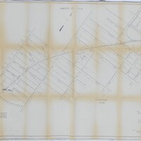
Cincinnati, Indianapolis, & Western RR Right of Way and Track Map - Taylorville Rd to Sangamon River (original 6/30/1918, revised 1/7/1955)
Tags: #8.003, 1/7/1955, 1918, 1955, 6/30/1918, B&O, Baltimore & Ohio Railroad Company, Cincinnati Indianapolis & Western RR, collection, Decatur IL, ISHRAB, ISHRAB-2017-25-10, ISHRAB-2017-25-4, Knights ILLS, map, Maps, Office of Valuation Engineer, public road, Railroad Map Collection, revised, right of way, right of way and track map, Sangamon River, Taylorville Road, Track
Cincinnati, Indianapolis & Western RR Station Map: Lands, Tracks, and Structures - 6th St to 11th St. (6/30/1918) (Partial Map)
Tags: #8.003, 1918, 6/30/1918, additions, B&O, Baltimore & Ohio Railroad Company, Cincinnati Indianapolis & Western RR, collection, Decatur IL, E. Eldorado St., E. Main St., E. North St., E. Prairie St., E. William St., E. Wood St., East View, Elm Ridge, Elson Heights, ISHRAB, ISHRAB-2017-25-142, lands, map, Maps, N. 10th St., N. 11th St., N. 6th St., N. 7th St., N. 8th St., N. 9th St., Nelson Park Rd., Office of Valuation Engineer, Railroad Map Collection, station map, Streets, structures, Tracks, Urban Place
Cincinnati, Indianapolis & Western RR Right of Way and Track Map - Fairview Ave to Franklin St. (6/30/1918 - Revised 6/7/1959)
Tags: #8.003, 1918, 1959, 6/30/1918, 6/7/1959, B&O, Baltimore & Ohio Railroad Company, Bright St., Cerro Gordo St., Church St., CI&W RR, Cincinnati Indianapolis & Western RR, collection, College St., Cottage Hill Ave., Decatur IL, Edward St., Fairview Ave., Haworth Ave., Home Ave., ISHRAB, ISHRAB-2017-25-9, map, Maps, Mason St., N. Main St., N. Mercer St., N. Monroe St., N. Pine St., N. Water St., Office of Valuation Engineer, Railroad Map Collection, revised, right of way, right of way and track map, S. Franklin St., S. Oakland Ave., Sangamon River, St. Louis Bridge, Streets, Sunset Ave., Track, Union St., Van Dyke St., W. Decatur St., W. Eldorado St., W. Forest Ave., W. Green St., W. King St., W. Macon St., W. Main St., W. North St., W. William St., W. Wood St., Wabash, Wabash Railroad, Wabash Railway, Wabash RR
Right of Way and Track Map - Cincinnati, Indianapolis, and Western RR, Operated by the Baltimore and Ohio Railroad Company (6/30/1918)
Tags: #8.003, 1918, 6/30/1918, Aaron Ruth, collection, Decatur Township, Euclid Broadwell, ISHRAB-2017-25-22, ISHRAB-2017-25-23, Jacob Stickle, John Garver, Joseph Spangler, Lake Decatur, Long Creek Township, map, Michael Eichinger, Michael Elson, Miller S. Fetrow, Nelson Park Drive, railroad, Railroad Map Collection, right of way, right of way and track map, Track, W.M. Davis, Wm. Deweese, Wm. Prather
Right of Way and Track Map - Cincinnati, Indianapolis, and Western RR, Operated by the Baltimore and Ohio Railroad Company (6/30/1918)
Tags: #8.003, 1918, 6/30/1918, Baltimore and Ohio Railroad Company, Cerro Gordo St., Cincinnati Indianapolis and Western RR, collection, Decatur IL, Fairview Ave, ISHRAB-2017-25-21, map, N. Water St., Oakland Ave, Office of Valuation Engineer, railroad, Railroad Map Collection, right of way and track map, Track, trackage rights, W. Eldorado St., W. Green St., W. King St., W. Main St., Wabash Railroad, Wabash RR
Station Map - Lands
Cincinnati, Indianapolis, and Western RR, Operated by Baltimore and Ohio Railroad Company (6/30/1918)
Tags: #8.003, 16th St., 17th St., 18th St., 1918, 6/30/1918, Baltimore and Ohio Railroad Company, Cincinnati Indianapolis and Western RR, collection, Decatur IL, E. Eldorado St., East St., ISHRAB-2017-25-18, ISHRAB-2017-25-19, Jasper St., L.P. Halliday Co. Addition, lands, map, Office of Chief Engineer, railroad, Railroad Map Collection, Rolling Mill Addition, S.C. Allens Addition, station map, Stone St., Track, Witt St.
Right of Way and Track Map - Cincinnati, Indianapolis, and Western RR, Operated by the Baltimore and Ohio Railroad Company (6/30/1918)
Tags: #8.003, 1918, 6/30/1918, B&O, Baltimore and Ohio Railroad Company, Cincinnati Indianapolis and Western RR, I.Q.A Odor, ISHRAB-2017-25-13, John W. Tyler, Long Creek IL, Long Creek Township, Miller S. Fietrow, Nathan N. Baker, Office of Valuation Engineer, railroad, Railroad Map Collection, right of way, Samuel B. Wortman, Samuel M.C. Davis, Samuel W. Gillespie, State Road 121, Sylvester C. Davis, Track, W.M. Davis
Right of Way and Track Map - Cincinnati, Indianapolis, and Western RR, Operated by the Baltimore and Ohio Railroad Company (6/30/1918)
Tags: #8.003, 1918, 6/30/1918, Allen Travis, Ambrose Greenfield, B&O, Baltimore and Ohio Railroad Company, Cincinnati Indianapolis and Western RR, collection, Henry W. Davis, ISHRAB-2017-25-12, James Millikin, John S. Kiser, land plats, Long Creek IL, Maps, N.L. Prather, railroad, Railroad Maps Collection, right of way, Samuel M.C. Davis, State Road 36, Track
Station Maps - Lands, Tracks, and Structures - Cincinnati, Indianapolis, and Western RR, Operated by Baltimore and Ohio Railroad Company (6/30/1918)
Tags: #8.003, 1918, 6/30/1918, B&O, Baltimore and Ohio Railroad Company, Cincinnati Indianapolis and Western RR, collection, Decatur IL, E. Eldorado St., ISHRAB-2017-25-15, ISHRAB-2017-25-17, ISHRAB-2017-25-7, ISHRAB-2017-25-8, Maps, rail yard, Railroad Map Collection, Roundhouse, station map, Streets, Wabash Roundhouse, Wabash yard


