Browse Items (9 total)
- Tags: St. Louis Bridge
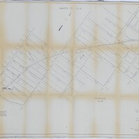
Wabash Railway Right of Way and Track Map - South of Rock Springs Rd. to Jackson St. (6/30/1919)
Tags: #8.003, 1919, 6/30/1919, Bridge, Bright St., Church St., collection, College St., Cottage Hill Ave., Decatur IL, Dunham St., Edward St., Fairview Ave., Fairview Rd., Haworth Ave., Home Ave., ISHRAB, ISHRAB-2017-25-125, Knights, Lincoln Park Dr., map, Maps, McClelland Ave., N. Franklin St., N. Jackson St., N. Main St., N. Mercer St., N. Monroe St., N. Oakland Ave., N. Pine St., N. Water St., Oakland Ct., Office of Chief Engineer, railroad, Railroad Ave., Railroad Map Collection, right of way, right of way and track map, Rock Springs Rd., S. Oakland Ave., Sangamon River, St. Louis Bridge, St. Louis Bridge Rd., State Route 48, State Rt. 48, Sunset Ave., Sycamore Ave., Track, Union St., University Ave., Van Dyke St., W. Cerro Gordo St., W. Decatur St., W. Eldorado St., W. Forest Ave., W. Green St., W. King St., W. Macon St., W. Main St., W. North St., W. William St., W. Wood St., Wabash, Wabash Railroad, Wabash Railway, Wabash RR, Willow Ave.
Cincinnati, Indianapolis & Western RR Right of Way and Track Map - Fairview Ave to Franklin St. (6/30/1918 - Revised 6/7/1959)
Tags: #8.003, 1918, 1959, 6/30/1918, 6/7/1959, B&O, Baltimore & Ohio Railroad Company, Bright St., Cerro Gordo St., Church St., CI&W RR, Cincinnati Indianapolis & Western RR, collection, College St., Cottage Hill Ave., Decatur IL, Edward St., Fairview Ave., Haworth Ave., Home Ave., ISHRAB, ISHRAB-2017-25-9, map, Maps, Mason St., N. Main St., N. Mercer St., N. Monroe St., N. Pine St., N. Water St., Office of Valuation Engineer, Railroad Map Collection, revised, right of way, right of way and track map, S. Franklin St., S. Oakland Ave., Sangamon River, St. Louis Bridge, Streets, Sunset Ave., Track, Union St., Van Dyke St., W. Decatur St., W. Eldorado St., W. Forest Ave., W. Green St., W. King St., W. Macon St., W. Main St., W. North St., W. William St., W. Wood St., Wabash, Wabash Railroad, Wabash Railway, Wabash RR
Wabash Railway Profile of Bridge 705 (9/6/1925)
Tags: #8.003, 1925, 9/6/1925, bridge 705, collection, Decatur IL, Elevation, ISHRAB-2017-25-129, map, Maps, Office of the Chief Engineer, profile, profile bridge 705, Railroad Map Collection, Sangamon River, St. Louis Bridge, Streets, W. Decatur St., W. Eldorado St., W. Forest Ave., W. Macon St., W. Main St., W. North St., W. William St., W. Wood St.
Right of Way and Track Map - Wabash Railway (6/30/1919)
Tags: #8.003, 1919, 6/30/1919, Cerro Gordo St., Decatur IL, Fairview Ave., ISHRAB-2017-25-25, map, N. Oakland Ave., Office of Chief Engineer, railroad, Railroad Map Collection, right of way, right of way and track map, Sangamon River, St. Louis Bridge, Track, W. Eldorado St., Wabash, Wabash Railway, west end, West Side


