Browse Items (9291 total)
League of Women Voters - Collections - Scrapbook - Articles - 1947 to 1952
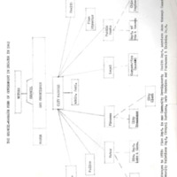
League of Women Voters - Collections - City of Decatur Government - City Manager Form of Government - Chart - 1962
League of Women Voters - Collections - American Alumni Council - Speech - Mr. John D. Rockefeller
James E. Henson' Oral HIstory - Transcription
Tags: 1984, automobile, Bar Association, bar exam, Betty Turnell, Bloomington IL, childhood, circuit judge, Clara May Morthland Henson, County bridge, County building, county judge, Decatur Daily Review, Decatur High School, Decatur IL, Departmental School, divorce law, Donald W. Morthland, early Decatur, Emanual Rosenberg, Eva Josephine Young, Fairview Shopping Center, family law, family life, Faries Park, Henson Morthland and Bolin, Henson Morthland and Henson, Illinois Wesleyan University, Interurban, interview, Jackson Street School, James Atlas Henson, James E. Henson, James Millikin University, January 1984, Lake Decatur, law practice, Lost Bridge, Macon County Court, Macon County Jail, Macon County Sheriff, Maffitt Street Bridge, Martin E. Morthland, Masonic Temple, OH73, oral history, Ray's Bridge, recording, Richard F. Morthland, Riverside School, Sangamon River, sound recording, Staley Office Building, transcription
J.C. Hostetler's Oral History - Transcription
Tags: 1985, 250 W. Prairie Ave., 4F, Albany Medical College, Bank Moritorium, Baseball, Betty Turnell, bond salesman, changes in banking, Chicago IL, Chief Surgeon, childhood, Cincinnati OH, city planning commission, Decatur IL, draft, estate work, Everett Mueller, family history, February 1985, Football, Great Depression, Halsey-Stuart and Company, Henry W. Waggoner, interview, J.C. Hostetler, John Hancock Life, Joseph C. Hostetler, law school, Liberal Arts College, Mayor, Middle States School of Banking, Millikin National Bank, Millikin University, Minnie I. Waggoner, Miss S. E. Kenney, modern banking, Monaham foreclosures, Mueller Company, National Life of Vermont, neighborhood, Northwestern Mutual Life Company, Northwestern University, OH74, oral history, Prudential Insurance Company of America, Quartermaster General's Packing House Division, recording, Robert B. Hostetler, sound recording, sound recordings, suppurating ear, Susan May Newland, transcription, Union College, University of Illinois, University of Minnesota, University of Wisconsin, Wabash Railroad, William B. Hostetler, World War I, WWI, Zone 7 Supply Depot Quartermaster Corps
Richard Rodgers' Oral History #1 - Transcription
Tags: 1984, air conditioning, automobiles, Baseball, Betty Turnell, Bijoux Theatre, Blue Book, board room, childhood, chimes, Clothing, Coal Mines, cook's stove, Decatur Civic Orchestra, Decatur IL, Decatur Public Library, Downtown, electricity, Empress Theatre, family orchestra, February 1984, Federal Home Loan Act, Feltman and Curm, FHA, First Methodist Church broadcast, Great Depression, Gushard Building, Gushard store, homogenization, Interurban, interview, John Philip Sousa's band, Lincoln Square, Lincoln Theatre, Linn and Scruggs, marimba, Millikin Orchestra, Millikin University, Music, Musician, Newspapers, oboe, OH75, oral history, pasteurization, public transportation, Pugh School, Radio, recording, refrigeration, Richard Rodgers, Roosevelt Junior High School, salt water taffy, shoe repair, Shoe Store, Shoes, shopping, sound recording, sound recordings, Stephen Decatur High School, Street Cars, Swarthout Brothers, telephones, The Anvil Chorus, transcription, Transfer House, triangle, unpaved streets, vaudeville theatre, vitaphone programs, WJBL station, World War I, WWI, xylophone
Richard Rodgers' Oral History #2 - Transcription
Tags: 1988, Amusement Park, Betty Turnell, Billy Sunday, carnivals, Circus, clearing tracks, crank, Decatur Club, Decatur IL, December 1988, drainage ditch, Dreamland Park, early 1900s, electric cars, gasoline heater, Home Telephone System, horse-drawn plow, horses, Hotel Orlando, interview, Lincoln Theatre, Linn and Scruggs, Millikin National Bank, OH76, oral history, plowing streets, Polar Ice Company, Postal Telegraph, Powers Opera House, Presbyterian Church, recording, Richard Rodgers, Riverside Park, sidewalks, sled, sleigh, sound recording, Street Cars, Streets, tires, touring car, transcription, Western Union, wood block pavement, YMCA
Loren Boatman's Oral History - Transcription
Tags: "live line" truck, 1986, August 1986, Betty Turnell, Bill Cecil, boating, cable television, cameras, Carl Hickerson, Carlinville IL, changes to broadcasting, changes to meteorology, Channel 17, childhood, Decatur Celebration, Decatur IL, Decatur Public Library, Don Foreman, government weather observer, Indiana State Teacher's College, interview, J. Giles, Korean War, Lake Decatur, Lakeview High School, lights, live broadcasts., live commercials, Loren Boatman, MacArthur High School, master's degree, meteorologist, Meteorology, microphones, microwave dishes, Navy, Northwestern Midshipmen School, Northwestern University, OH77, oral history, Pacific Ocean, photography, piano, recording, sound recording, sound recordings, Southern Illinois University, Teacher, Television, transcription, traveling, University of Illinois, WAND
Frankye Morgan's Oral History - Transcription
Tags: "Cotton Ball", 1986, African Methodist Episcopal Church, Awards, beauty school, Betty Turnell, bi-centennial celebration, Black History Week, Blue Mound IL, brotherhood week, car cleaner, car oiler, Centennial School, Central Christian Church, Chattanooga TN, Chicago IL, childhood, choir, cosmetology course, Decatur IL, discrimination, Elementary Education, First Baptist Church, First Methodist Church, First Presbyterian Church, food awards, Frankye Morgan, Garden Club of Decatur, gardening, gardening awards, Grant's farm, Home Economics, Illinois Junior Academy of Science, integration, interview, January 1986, Joe Russell, Johns Hill School, Josie Russell, Leotyne Price, Lincoln School, Madison IL, master's degree, Moler Beauty College, Museum of Science and Industry, Northwestern University, OH78, oral history, Parent-Teacher Association, physical education, PTA, PTA award, racial relations, racial tensions, recording, Redwood Restaurant, retirement, Roosevelt Junior High School, Rosarian, Science, Science Club, science fair, singing, Smith-Hughes Act, sound recording, sounds recordings, Springfield Civic Garden Club, Springfield Garden Club, St. Paul's Lutheran Church, summer school, summer science club, Teacher, teaching, Tennessee State University, transcription, U of I Extension department, weather balloon, Westminster Presbyterian Church, Wilberforce University, Woodrow Wilson Junior High School, Xenia OH
Mr. and Mrs. William Bankson's Oral History - Transcription
Tags: 1986, 4-H. Bethany IL, big hook, Boy Scouts, childhood, choir, clothing donation, Decatur IL, Decatur round house, diesel locomotives, electric welding trade, family life, First United Methodist Church, Forsyth IL, grease cup filler, Great Depression, handyman, Hubert Bankson, interview, labor gang, machinist, machinist's helper, March 1986, Marilyn Bankson, Mexico, mission, Mr. and Mrs. William Bankson, Mrs. William Bankson, Music, North Dakota, OH80, oral history, passenger trains, recording, round house, Roundhouse, sound recording, steam crane, Steam Locomotives, train wrecks, Trains, transcription, travelling, Wabash Railroad, William Bankson, wrecker, wrecking crew

