Browse Items (9 total)
- Tags: N. Oakland Ave.
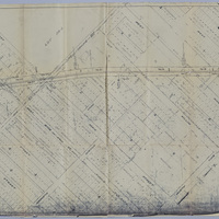
Wabash Railway Right of Way and Track Map - South of Rock Springs Rd. to Jackson St. (6/30/1919)
Tags: #8.003, 1919, 6/30/1919, Bridge, Bright St., Church St., collection, College St., Cottage Hill Ave., Decatur IL, Dunham St., Edward St., Fairview Ave., Fairview Rd., Haworth Ave., Home Ave., ISHRAB, ISHRAB-2017-25-125, Knights, Lincoln Park Dr., map, Maps, McClelland Ave., N. Franklin St., N. Jackson St., N. Main St., N. Mercer St., N. Monroe St., N. Oakland Ave., N. Pine St., N. Water St., Oakland Ct., Office of Chief Engineer, railroad, Railroad Ave., Railroad Map Collection, right of way, right of way and track map, Rock Springs Rd., S. Oakland Ave., Sangamon River, St. Louis Bridge, St. Louis Bridge Rd., State Route 48, State Rt. 48, Sunset Ave., Sycamore Ave., Track, Union St., University Ave., Van Dyke St., W. Cerro Gordo St., W. Decatur St., W. Eldorado St., W. Forest Ave., W. Green St., W. King St., W. Macon St., W. Main St., W. North St., W. William St., W. Wood St., Wabash, Wabash Railroad, Wabash Railway, Wabash RR, Willow Ave.
Wabash Railway Right of Way and Track Map - Wyckles to N. Mercer St. (6/30/1919)
Tags: #8.003, 1919, 6/30/1919, Ashland Ave., Cerro Gordo St., Cobb Ave., collection, Decatur IL, Decatur Township, Dennis Ave., Dunham St., Fairlawn Ave., Fairlawn Cemetery, Fairview Park, Harristown Township, Home Ave., Illinois Traction System, ISHRAB, ISHRAB-2017-25-112, ITS, map, Maps, McClelland Ave., N. Fairview Ave., N. Mercer St., N. Oakland Ave., N. Pine St., Oakdale Ave., Office of Chief Engineer, Park Place, Prairie Ave., Railroad Map Collection, right of way, right of way and track map, Streets, Summit Ave., Taylor Ave., Track, University Ave., Van Dyke St., Victoria Ave., W. Eldorado St., W. Green St., W. King St., W. Main St., W. Marietta St., W. North St., W. Packard St., W. William St., Wabash, Wabash Railroad, Wabash Railway, Wabash RR, Westlawn Ave., Woodlawn Ave., Wyckles
Wabash Railway Station Map: Lands, Tracks, and Structures - Fairview Ave. to College St. (6/30/1938)
Tags: 1938, 6/30/1938, A.Wait's et all A&P Addition, Adamson & Prather's Addition, additions, Anna B. Millikin Home, Avenue Park Addition, Bright St., businesses, Caldwell's Resurvey, Cerro Gordo St., collection, College St., Cottage Hill St., Decatur IL, Dunham's Addition, E.B. Durfee's 1st Addition, E.B. Durfee's 2nd Addition, E.B. Durfee's 3rd Addition, F.E. Kinney's Addition, Fairview Ave., George A. Wessel's Addition, H.A. Wood's Addition of Outlots, H.H. Brown's 2nd Subdivision, H.H. Brown's Subdivision, H.S. Evan's 2nd Subdivision, H.S. Evan's Subdivision, Haworth Ave., Hiram Johnson's Subidivision, Home Ave., ISHRAB, ISHRAB-2017-25-107, John Allen resurvey, lands, Locus Addition, map, Maps, Marilla Dunham Place, McCaskill's 2nd Addition, McCaskill's 3rd Addition, Millikin Place., Millikin's 2nd Addition, Millikin's Addition, N. Mercer St., N. Monroe St., N. Oakland Ave., N. Pine St., Oakland Place, Oaklawn, Office of Chief Engineer, Peter H. Brueck's 2nd Addition, Peter H. Brueck's Addition, Polar Ice Co., Prairie Ave., Railroad Map Collection #8.003, S. Oakland Ave., S.K. Thompson's 2nd Addition, S.K. Thompson's Addition, Simpson's 2nd Addition, Simpson's Addition, station map, Streets, structures, Tracks, University Place, Van Dyke St., W. Decatur St., W. Eldorado St., W. Forest Ave., W. Green St., W. Macon St., W. Main St., W. North St., W. Williams St., W. Wood St., Wabash, Wabash Railroad, Wabash Railway, Wabash RR, Western Addition, Woodland Addition, Yates & King's Addition
Wabash Railway Station Map: Lands, Tracks, & Structures - Fairview Ave. to Monroe St. (6/30/1919)
Tags: #8.003, 6/30/1919, A. Watts Addition, Adamson & Prather's Addition, additions, Anna B. Millikin Home, Avenue Park Addition, Bright St., Bundy's Addition, businesses, Cerro Gordo St., collection, College St., Cottage Hill Ave. Sunset Ave., Decatur IL, Dunham's Addition, E.B. Durfee's 2nd Addition, E.B. Durfee's 3rd Addition, E.B. Durfee's Addition, George F. Wessel's Addition, H.A. Wood Addition, H.H. Brown's 2nd Subdivision, H.H. Brown's Subdivision, H.S. Evan's Subdivision, H.S. Evans 2nd Subdivision, Hiram Johnson's Subdivision, Home Ave., Isabell's Addition, ISHRAB, ISHRAB-2017-25-130, John Allen resurvey, lands, Locus Addition, map, Maps, Marilla Dunham Place, McCaskill's 2nd Addition, McCaskill's 3rd Addition, Mercer St., Millikin Place, Millikin's 2nd Addition, Millikin's Addition, Mueller Manufacturing Co., Mueller's Addition, N. Monroe St., N. Oakland Ave., N. Pine St., Oakland Place, Oaklawn Addition, Office of Chief Engineer, Peter H. Brueck's 2nd Addition, Peter H. Brueck's Addition, Polar Ice Co., R.E. Kinney's Addition, railroad, Railroad Map Collection, S.K. Thompson's 2nd Addition, S.K. Thompson's Addition, Simpson's 2nd Addition, Simpson's Addition, station map, Streets, structures, Tracks, University Place, Van Dyke St., W. Decatur St., W. Eldorado St., W. Forest Ave., W. Green St., W. Macon St., W. Main St., W. North St., W. William St., W. Wood St., Wabash, Wabash Railroad, Wabash Railway, Wabash RR, West Park Addition of out lots, Woodland Addition, Yates & King's Addition
Wabash Railway Right of Way and Track Map - From Wyckles Land in Harristown Township to N. Mercer St. (6/30/1919)
Tags: #8.003, 1919, 6/30/1919, Ashland Ave., Cobb Ave., collection, Decatur IL, Decatur Township, Dennis Ave., Dunham St., E-Z Opener Bag Co., Fair Lawn Ave., Fairlawn Cemetery, Fairview Park, Harristown Township, Home Ave., Ice Plant, Illinois Terminal System, Illinois Traction System, ISHRAB, ISHRAB-2017-25-82, ITS, map, Maps, McClelland Ave., N. Fairview Ave., N. Mercer St., N. Oakland Ave., N. Pine St., Oakdale Bl., Office of Chief Engineer, Park Place, Prairie Ave., Railroad Map Collection, right of way, right of way and track map, roadway, Summit Ave., Taylor Ave., Track, University Ave., Van Dyke St., Victoria Ave., W. Cerro Gordo St., W. Eldorado St., W. Green St., W. King St., W. Marietta St., W. North St., W. Packard St., W. William St., Wabash, Wabash Railroad, Wabash Railway, Wabash RR, Westlawn Ave., Woodlawn Ave., Wyckles, Wyckles land, Wyckles plat
Illinois Central Railroad Right of Way and Track Map - E. North St. to E. Harrison St. (12/31/1935)
Tags: #8.003, 12/31/1935, 1935, additions, Assessor's subdivision, Barber's subdivision, Becker Ave., Becker Place, Broadway St., Center St., Central Ave., Church Hill Addition, Clayton St., Clinton St., collection, Columbia Heights, Commissioner's Division, Condit St., Cushing St., D.F. Shelley's Addition, David Brett, Decatur IL, description, Division St., Dunham St., E. Cerro Gordo St., E. Eldorado St., E. North St., E.B. Quinlan 1st Addition, E.B. Quinlan 3rd Addition, E.B. Quinlan's 2nd Addition, E.O. Smith, Gaddis Addition, Garfield Ave., Graceland Ave., Grand Ave., Gulick St., H.A. Hayes et all, H.A. Wood's Addition, Handy's addition, Harrison St., Hay St., Herkimer St., Hickory St., Homestead Addition, Hunt St., Hunter's Addition, Huron St., I.C. Pugh's subdivision of estate, ICRR, ICRR depot, ICRR freight house, Illinois Central Railroad, ISHRAB-2017-25-101, Jasper St., Kincaid's Addition, King St., Leafland Ave., Lesley subdivision, Locust St., M. Johnson's subdivision, M.C. Deck's Addition, map, Maple Ave., Maple St., Maps, Marietta St., Mason St., Mercer St., Montgomery Shull's 1st Addition, Montgomery Shull's 2nd Addition, Morgan St., N. Church St., N. College St., N. Edward St., N. Main St., N. Monroe St., N. Oakland Ave., N. Pine St., N. Union St., N. Water St., Northside Addition, Office of Assistant of Division Engineer, Olive St., Pleasant View, Prather subdivision, R.C. Augustine's Addition, railroad, Railroad Ave., Railroad Map Collection, Richview, right of way, right of way and track map, Sangamon St., Short St., Smith Company's Addition, Stare's Addition, Staurt St. Division St., Stephen's Creek, stock pens, Streets, subdivisions, Taft St., Towl's Addition, Tracks, Traver's subdivision, Van Dyke St., View St., W. Cerro Gordo St., W. Eldorado St., W. Green St., W. King St., W. Marietta St., W. North St., W. Packard St., Wabash, Wabash Depot, Wabash freight house, Wabash Railroad, Wabash Railway, Wabash Roundhouse, Wabash RR, Wabash yards, Waggoner St., Walnut Grove, Whitchell St., Whitchell's Addition, Wilber St., William's Subdivision
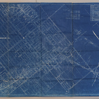
Right of Way and Track Map - Wabash Railway (6/30/1919)
Tags: #8.003, 1919, 6/30/1919, Cerro Gordo St., Decatur IL, Fairview Ave., ISHRAB-2017-25-25, map, N. Oakland Ave., Office of Chief Engineer, railroad, Railroad Map Collection, right of way, right of way and track map, Sangamon River, St. Louis Bridge, Track, W. Eldorado St., Wabash, Wabash Railway, west end, West Side


