Browse Items (110 total)
- Collection: Railroad Map Collection #8.003
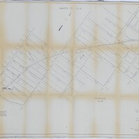
Cincinnati, Indianapolis & Western RR Right of Way and Track Map - Fairview Ave to Franklin St. (6/30/1918 - Revised 6/7/1959)
Tags: #8.003, 1918, 1959, 6/30/1918, 6/7/1959, B&O, Baltimore & Ohio Railroad Company, Bright St., Cerro Gordo St., Church St., CI&W RR, Cincinnati Indianapolis & Western RR, collection, College St., Cottage Hill Ave., Decatur IL, Edward St., Fairview Ave., Haworth Ave., Home Ave., ISHRAB, ISHRAB-2017-25-9, map, Maps, Mason St., N. Main St., N. Mercer St., N. Monroe St., N. Pine St., N. Water St., Office of Valuation Engineer, Railroad Map Collection, revised, right of way, right of way and track map, S. Franklin St., S. Oakland Ave., Sangamon River, St. Louis Bridge, Streets, Sunset Ave., Track, Union St., Van Dyke St., W. Decatur St., W. Eldorado St., W. Forest Ave., W. Green St., W. King St., W. Macon St., W. Main St., W. North St., W. William St., W. Wood St., Wabash, Wabash Railroad, Wabash Railway, Wabash RR
Cincinnati, Indianapolis & Western RR Station Map: Lands, Tracks, and Structures - 6th St to 11th St. (6/30/1918) (Partial Map)
Tags: #8.003, 1918, 6/30/1918, additions, B&O, Baltimore & Ohio Railroad Company, Cincinnati Indianapolis & Western RR, collection, Decatur IL, E. Eldorado St., E. Main St., E. North St., E. Prairie St., E. William St., E. Wood St., East View, Elm Ridge, Elson Heights, ISHRAB, ISHRAB-2017-25-142, lands, map, Maps, N. 10th St., N. 11th St., N. 6th St., N. 7th St., N. 8th St., N. 9th St., Nelson Park Rd., Office of Valuation Engineer, Railroad Map Collection, station map, Streets, structures, Tracks, Urban Place
Cincinnati, Indianapolis, & Western RR Right of Way and Track Map - Taylorville Rd to Sangamon River (original 6/30/1918, revised 1/7/1955)
Tags: #8.003, 1/7/1955, 1918, 1955, 6/30/1918, B&O, Baltimore & Ohio Railroad Company, Cincinnati Indianapolis & Western RR, collection, Decatur IL, ISHRAB, ISHRAB-2017-25-10, ISHRAB-2017-25-4, Knights ILLS, map, Maps, Office of Valuation Engineer, public road, Railroad Map Collection, revised, right of way, right of way and track map, Sangamon River, Taylorville Road, Track
Illinois Central Railroad - Curtis St. to SBI Route 48 & 121 (4/3/1935)
Tags: #8.003, 1935, 4/3/1935, Arlington St., collection, Curtis St., Decatur IL, Dillehunt Heirs, ICRR, Illinois Central Railroad, Illinois Terminal Railroad, ISHRAB-2017-25-103, ITS, map, Maps, Millikin Bank & Trust, Mueller Estate, Pennsylvania Railroad, Pennsylvania RR, Pershing Rd, Railroad Map Collection, Rt. 48 & 121, SBI Route 48 & 121, Van Buren St.
Illinois Central Railroad - Showing Sewers & Pavement at Prairie St. Subway (5/20/1916)
Illinois Central Railroad Company Station Plat - Wilbur St. to N. Clinton St. (1/14/1911)
Tags: #8.003, 1/14/1911, 1911, Alexander Lumber Company, Beiman Heights Addition, C.C. Morrison Addition, C.W. Handy Addition, Church Hill Addition, collection, Decatur IL, E. Center St., E. Division St., F.M. Gaddis Addition, Francis St., Garfield Ave., Graceland Ave., Grand Ave., Harrison Ave., Hunter Bros. Addition, I.A. William's Resurvey, ICRR, Illinois Central Railroad, Illinois Central Railroad Company, Illinois Traction System, ISHRAB, ISHRAB-2017-25-85, ITS, Johnson Ave., M. Johnson subdivision, map, Maple St., Maps, N. Broadway St., N. Church St., N. Clinton St., N. College St., N. Edward St., N. Main St., N. Monroe St., N. Morgan St., N. Union St., N. Warren St., N. Water St., Olive St., Property of W.G. Traver Co., Railroad Map Collection, Richview, Roadmaster's Office, station plat map, W. Johnson St., Whitchell Addition, Whitchell Ave., Wilbur St., William's Subdivision
Illinois Central Railroad from Division St. to Curtis Ave. (10/21/1958)
Tags: #8.003, 10/21/1958, 1958, Alexander Lumber Co., asphalt plant, Calhoun St., collection, Curtis Ave., Decatur IL, Division St., Elmhurst Ave., Garfield Ave., Harrison Ave., Houdaille Industries, ICRR, ICRR coal yard, ICRR water tank, Illinois Central Railroad, ISHRAB-2017-25-32, Maps, Mueller Ave., Office of Assistant Engineer, Perfect Potato Chip Co., Railroad Ave., Railroad Map Collection, Streets, Sunshine Biscuit Company, Warehouse Builders Supply Company
Illinois Central Railroad from Division St. to Curtis Ave. (4/3/1935, revised 1952)
Tags: #8.003, 1935, 4/3/1935, Alexander Lumber Co., Biflex Products Company, Curtis Ave., Decatur Brick Manufacturing Co. Plant, Decatur IL, Division St., Division St. to Curtis Ave., Elmhurst Ave., Garfield Ave., Harrison Ave., ICRR, ICRR coal yard, ICRR water tank, Illinois Central Railroad, ISHRAB-2017-25-31, ISHRAB-2017-25-62, map, Mueller Ave., Office of Assistant Engineer, Railroad Map Collection, Streets, Tracks
Illinois Central Railroad Map - Sangamon River to Washington St. (3/25/1924)
Tags: #8.003, 1924, 3/25/1924, additions, Broadway St., businesses, City Waterworks, collection, Cope & Fisher, Decatur IL, Decatur Sienite Granite Co., Decatur St., Deep Rock Oil Corp., E.E. Lily & Son, Gault St., Gault's 1st Addition, Gault's 2nd Addition, ICRR, Illinois Central Railroad, ISHRAB-2017-25-65, J.K. Warren's South Addition, J.N. Bills Addition, Jackson St., Macon St., map, Maps, Office of Assistant Engineer, Oglesby & Waits Addition, Railroad Map Collection, S. Franklin St., S. Main St., Sangamon River, Sinclair Oil and Refining Co., Streets, Track, Tracks, Washington St.
Illinois Central Railroad Map - Sangamon St. to Division St. (1/10/1935)
Tags: #8.003, 1/10/1935, 1935, Alexander Lumber Co., Broadway St., Calhoun St., Center St., Clayton St., collection, Condit St., Decatur Brick Manufacturing Co., Decatur IL, Division St., Eldorado Oil Co., Esplanade St., Faries Manufacturing Co., Grand Ave., Hickory St., ICRR, ICRR yards, Illinois Central Railroad, ISHRAB-2017-25-63, Leafland Ave., Locust St., map, Maps, Marietta St., Morgan St., Office of Assistant Engineer, Orchard St., Pennsylvania Railroad, Pennsylvania RR, Pennsylvania RR yards, Railroad Ave., Railroad Map Collection, Sangamon St., Yards


