Browse Items (18 total)
- Tags: right of way and track map
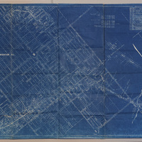
Illinois Central Railroad Right of Way and Track Map - E. North St. to E. Harrison St. (12/31/1935)
Tags: #8.003, 12/31/1935, 1935, additions, Assessor's subdivision, Barber's subdivision, Becker Ave., Becker Place, Broadway St., Center St., Central Ave., Church Hill Addition, Clayton St., Clinton St., collection, Columbia Heights, Commissioner's Division, Condit St., Cushing St., D.F. Shelley's Addition, David Brett, Decatur IL, description, Division St., Dunham St., E. Cerro Gordo St., E. Eldorado St., E. North St., E.B. Quinlan 1st Addition, E.B. Quinlan 3rd Addition, E.B. Quinlan's 2nd Addition, E.O. Smith, Gaddis Addition, Garfield Ave., Graceland Ave., Grand Ave., Gulick St., H.A. Hayes et all, H.A. Wood's Addition, Handy's addition, Harrison St., Hay St., Herkimer St., Hickory St., Homestead Addition, Hunt St., Hunter's Addition, Huron St., I.C. Pugh's subdivision of estate, ICRR, ICRR depot, ICRR freight house, Illinois Central Railroad, ISHRAB-2017-25-101, Jasper St., Kincaid's Addition, King St., Leafland Ave., Lesley subdivision, Locust St., M. Johnson's subdivision, M.C. Deck's Addition, map, Maple Ave., Maple St., Maps, Marietta St., Mason St., Mercer St., Montgomery Shull's 1st Addition, Montgomery Shull's 2nd Addition, Morgan St., N. Church St., N. College St., N. Edward St., N. Main St., N. Monroe St., N. Oakland Ave., N. Pine St., N. Union St., N. Water St., Northside Addition, Office of Assistant of Division Engineer, Olive St., Pleasant View, Prather subdivision, R.C. Augustine's Addition, railroad, Railroad Ave., Railroad Map Collection, Richview, right of way, right of way and track map, Sangamon St., Short St., Smith Company's Addition, Stare's Addition, Staurt St. Division St., Stephen's Creek, stock pens, Streets, subdivisions, Taft St., Towl's Addition, Tracks, Traver's subdivision, Van Dyke St., View St., W. Cerro Gordo St., W. Eldorado St., W. Green St., W. King St., W. Marietta St., W. North St., W. Packard St., Wabash, Wabash Depot, Wabash freight house, Wabash Railroad, Wabash Railway, Wabash Roundhouse, Wabash RR, Wabash yards, Waggoner St., Walnut Grove, Whitchell St., Whitchell's Addition, Wilber St., William's Subdivision
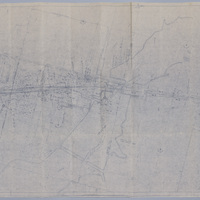
Wabash Railroad Right of Way and Track Map - 27th St. Through Lake Decatur (7/1/1953)
Tags: #8.003, 1953, 24th St., 25th St., 26th St., 27th St., 29th St., 31st St., 32nd St., 33rd St., 34th St., 35th St., 7/1/1953, A.E. Staley Manufacturing Co., additions, businesses, Camp and Emrich Addition of outlots, Camp and Emrich's 2nd Addition of outlots, collection, Decatur IL, Donovan Heights Addition, E. Division St., E. Grand Ave., E. Hickory St., E. Locust St., E. Logan St., E. Olive St., Faries Parkway, Fern Ct., Garden Place, Garfield Ave., Geddes Ave., Hillcrest Dr., Homewood Ave., ISHRAB-2017-25-93, James St., Lake Decatur, Lakewood Ave., map, Maps, Office of Chief Engineer, public road, Raceland Plat "C" in Plat "C", Raceland Plat "D" in Plat "A", Railroad Map Collection, right of way, right of way and track map, Samuels St., Spencer-Kellogg & Son Co., State Route 47, Streets, Track, track map, Tracks, Wabash Railroad, Wabash Railway, Wabash RR, Wabash yards, West Lake Addition outlots, Yards
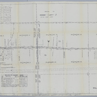
Illinois Traction Inc. Right of Way and Track Map - Running North from Race Track (12/31/1928)
Tags: #8.003, 12/31/1928, 1928, additions, Bradley & Campbell's Addition of out lots 2nd addition, collection, Decatur IL, ICRR, Illinois Central Railroad, Illinois Terminal Company, Illinois Terminal System, Illinois Traction Inc., Illinois-Iowa Power Co. substation, ISHRAB-2017-25-102, ISHRAB-2017-25-76, ITS, Kenwood Ave., map, Maps, Maywood Ct., McKinley Ave., Melrose Ct., N. Broadway St., N. Church St., N. Main St., N. Morgan St., N. Water St., Office of Chief Engineer, Poyntalle Downing Property, Race Track, Railroad Map Collection, record of changes made, right of way, right of way and track map, Streets, Track, track map, Tracks, Valuation Division, Van Buren St.
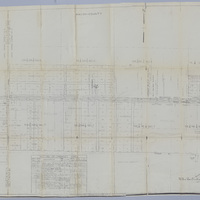
Illinois Traction Inc. Right of Way and Track Map - E. Garfield Ave. (12/31/1928, revised 3/9/1945)
Tags: #8.003, 12/31/1928, 1928, additions, Brush College Road, businesses, Cassel St., collection, Decatur IL, Division St., Garden Place, Garfield Ave., Geddes Ave., Heminger Heights, Homeland Addition, Illinois Terminal Company, Illinois Traction Inc., ISHRAB-2017-25-71, ITS, Logan St., map, Maps, Ninth St., Olive St., Phares Elwood Resurvey, public road, Race plat A, Race subdivision, Raceland Addition, Raceland subdivision of lot A plat C, Raceland subdivision plat A, Railroad Map Collection, record of changes made, right of way, right of way and track map, Spencer Kellogg, Streets, Swartz Siding, Track, track map, Tracks, Wabash, Wabash Railroad, Wabash Railway, Wabash RR, West Lake 3rd Addition of out lots, Weys lots 7 & 8
Right of Way and Track Map for Illinois Traction Inc., Operated by Illinois Terminal Company - Brush College Rd to 2 Miles East Across Lake Decatur (12/31/1928, revised 3/7/1933)
Tags: #8.003, 12/31/1928, 1928, collection, Decatur IL, Decatur Township, Illinois Terminal Company, Illinois Traction Inc., ISHRAB-2017-25-68, Keller Siding, Lake Decatur, map, Maps, Oakley Township, public road, Railroad Map Collection, record of changes made, right of way, right of way and track map, Track, Wabash, Wabash Railroad, Wabash Railway, Wabash RR.
Right of Way and Track Map - Wabash Railway (6/30/1919)
Tags: #8.003, 1919, 6/30/1919, Cerro Gordo St., Decatur IL, Fairview Ave., ISHRAB-2017-25-25, map, N. Oakland Ave., Office of Chief Engineer, railroad, Railroad Map Collection, right of way, right of way and track map, Sangamon River, St. Louis Bridge, Track, W. Eldorado St., Wabash, Wabash Railway, west end, West Side
Right of Way and Track Map - Cincinnati, Indianapolis, and Western RR, Operated by the Baltimore and Ohio Railroad Company (6/30/1918)
Tags: #8.003, 1918, 6/30/1918, Aaron Ruth, collection, Decatur Township, Euclid Broadwell, ISHRAB-2017-25-22, ISHRAB-2017-25-23, Jacob Stickle, John Garver, Joseph Spangler, Lake Decatur, Long Creek Township, map, Michael Eichinger, Michael Elson, Miller S. Fetrow, Nelson Park Drive, railroad, Railroad Map Collection, right of way, right of way and track map, Track, W.M. Davis, Wm. Deweese, Wm. Prather
Right of Way and Track Map - Cincinnati, Indianapolis, and Western RR, Operated by the Baltimore and Ohio Railroad Company (6/30/1918)
Tags: #8.003, 1918, 6/30/1918, Baltimore and Ohio Railroad Company, Cerro Gordo St., Cincinnati Indianapolis and Western RR, collection, Decatur IL, Fairview Ave, ISHRAB-2017-25-21, map, N. Water St., Oakland Ave, Office of Valuation Engineer, railroad, Railroad Map Collection, right of way and track map, Track, trackage rights, W. Eldorado St., W. Green St., W. King St., W. Main St., Wabash Railroad, Wabash RR

