Browse Items (24 total)
- Tags: N. Water St.
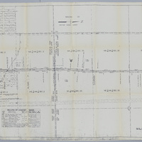
Illinois Traction Inc. Right of Way and Track Map - Running North from Race Track (12/31/1928)
Tags: #8.003, 12/31/1928, 1928, additions, Bradley & Campbell's Addition of out lots 2nd addition, collection, Decatur IL, ICRR, Illinois Central Railroad, Illinois Terminal Company, Illinois Terminal System, Illinois Traction Inc., Illinois-Iowa Power Co. substation, ISHRAB-2017-25-102, ISHRAB-2017-25-76, ITS, Kenwood Ave., map, Maps, Maywood Ct., McKinley Ave., Melrose Ct., N. Broadway St., N. Church St., N. Main St., N. Morgan St., N. Water St., Office of Chief Engineer, Poyntalle Downing Property, Race Track, Railroad Map Collection, record of changes made, right of way, right of way and track map, Streets, Track, track map, Tracks, Valuation Division, Van Buren St.
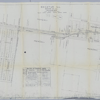
Illinois Central Railroad Station Plat Map - Graceland Ave. to Morgan St. (12/1928)
Tags: #8.003, 12/1928, 1928., additions, businesses, Church Hill Addition, collection, Columbia Heights Addition, D.F. Shelley Addition, Decatur IL, E. Division St., E.M. Gaddis Addition, Economy Coal Co., Francis St., G.W. Handy Addition, Garfield Ave., Gebhart Court, Graceland Ave., H.A. Wood Addition, Hunter Bros. Addition, ICRR, Illinois Central Railroad, Illinois Traction System, ISHRAB-2017-25-67, ITS, Johnson Ave., map, Maps, Morrison Addition, N. Broadway, N. Church St., N. College St., N. Edward St., N. Main St., N. Monroe St., N. Morgan St., N. Union St., N. Warren St., N. Water St., North Side, Olive St., Peoria Ave., R.C. Augustine Addition, Railroad Map Collection, Richview, Roadmaster's Office, Sawyer St., station plat map, Streets, Track, Tracks, W. Johnson St., W. Olive St., W.A. William's Resurvey, W.G. Traver Co., Whichel Addition, Whitchel Ave., William's Subdivision
Illinois Central Railroad Station Plat Map - Center St. to N. Union St. (6/10/1952)
There are 2 ISHRAB-2017-25-58 maps in the physical collection. Only…
Tags: 1952, 6/10/1952, additions, Alexander Lumber Co., Arnold Coal Company, Builders Supply Company, businesses, C.W. Handy Addition, Center St., Church Hill Addition, Clinton St., collection, Columbia Heights Addition, D.F. Shelley Addition, Decatur IL, E. Division St., F.M. Gaddis Addition, Francis St., Garfield Ave., H.A. Wood Addition, Hunter Bros. Addition, ICRR, ICRR yards, Illinois Central Railroad, ISHRAB-2017-25-58, ISHRAB-2017-25-59, Johnson Ave., M. Johnson subdivision, map, Maps, Morgan St., N. Broadway St., N. Church St., N. Main St., N. Union St., N. Warren St., N. Water St., North Side, Olive St., Pennsylvania Railroad, Pennsylvania RR, Peoria Cartage Co., R.C. Augustine Addition, Railroad Map Collection, Richview, Skelley 2 Oil Station, Stares Addition, station plat, station plat map, Streets, Superior Welding Co., Tracks, W. Johnson St., W.G. Traver Co., Whitchel Addition, Williams Subdivision, Yards
Map of the ICRR Belt Line from Peoria Branch of ICRR to Main Line of ICRR (Church St. to Morgan St.)
Tags: belt line, belt line map, Bloomington Decatur & Champaign RR, Bradley Campbells 2nd Addition, Bradley Campbells Addition of Out Lots, collection, Decatur IL, ICRR, Illinois Central Railroad, ISHRAB-2017-25-45, main line, map, McKinley Ave., N. Church St., N. Main St., N. Morgan St., N. Water St., Peoria branch, Pythian Ave., Pythian Home Addition, Railroad Map Collection, Tracks
Station Maps of the Illinois Traction Inc., Operated by Illinois Terminal Company (12-31-1928)
Tags: #8.003, 12/31/1928, 1928, Butler Heights, Church St., collection, Decatur IL, Graceland Ave., Illinois Terminal Company, Illinois Traction Inc., ISHRAB-2017-25-42, ISHRAB-2017-25-43, ITS, Kenwood Ave., Maps, Maywood Court, McKinley Ave., Melrose Court, N. Main St., N. Water St., Office of Chief Engineer, Pythian Ave., Pythian Home, Pythian Home Addition, Railroad Map Collection, records of changes made, Resers Addition, Rosedale Addition, Rosedale Ave., station map, station maps, Tangney Addition, Union Blvd., Valuation Division
Right of Way and Track Map - Cincinnati, Indianapolis, and Western RR, Operated by the Baltimore and Ohio Railroad Company (6/30/1918)
Tags: #8.003, 1918, 6/30/1918, Baltimore and Ohio Railroad Company, Cerro Gordo St., Cincinnati Indianapolis and Western RR, collection, Decatur IL, Fairview Ave, ISHRAB-2017-25-21, map, N. Water St., Oakland Ave, Office of Valuation Engineer, railroad, Railroad Map Collection, right of way and track map, Track, trackage rights, W. Eldorado St., W. Green St., W. King St., W. Main St., Wabash Railroad, Wabash RR
Aerial Photos of Brettwood Mall
Tags: 1962, Aerial View, Brettwood Mall, BS968, BS969, BS970, Business, Construction, Decatur IL., Malls, N. Water St., Pershing Road, Rt. 51 North


